Best Navigation App for Italy Road Trip: Complete Guide & Comparison

by Luca | Last Updated January 5, 2026

Accidenti! After twenty years of navigating Italian roads and watching countless tourists get hopelessly lost despite having the latest smartphones, I need to tell you something crucial: not all navigation apps understand Italy’s unique driving challenges.
I’ve seen visitors follow their GPS directly into ZTL zones and get €100 tickets, watched them try to drive rental cars down pedestrian-only medieval streets, and helped rescue travelers whose apps led them up mountain roads that don’t actually exist anymore!
Here’s what most travel guides won’t tell you: Italy’s road system combines ancient Roman routes, medieval village layouts, and modern highways in ways that confuse even sophisticated navigation technology. Our historic centers change traffic restrictions hourly, mountain passes close without warning, and some of our most beautiful destinations can only be reached by roads that satellite maps haven’t updated since the Renaissance.

The truth is, successful Italian road trip navigation requires understanding which apps actually work in our specific conditions, how to use them properly, and – most importantly – when to ignore them completely and follow local knowledge.
From apps that understand ZTL zones to offline maps that work in mountain areas without cell coverage, the right navigation choice transforms potential disasters into smooth Italian adventures where you can focus on enjoying our incredible country instead of cursing at your phone.

Google Maps for Italy: Strengths, Weaknesses, and Best Practices
Allora, let’s start with the obvious choice that most tourists use – Google Maps. After twenty years of driving Italian roads and helping countless visitors navigate our sometimes chaotic infrastructure, I can tell you that Google Maps works well for basic Italian navigation, but you need to understand its limitations to use it effectively.
Google Maps excels at real-time traffic updates on major Italian highways. The A1 from Milan to Rome, coastal routes during summer, and city centers during rush hour – Google accurately predicts delays and suggests alternatives. This saves hours during peak travel times when Italian traffic becomes absolutely insane.
But here’s where it gets tricky – ZTL zones. Google Maps knows about some restricted traffic areas, but not all of them, and the information isn’t always current. I’ve watched tourists confidently follow Google directions straight into Florence’s centro storico and get automatic tickets that cost more than their hotel room. The app is getting better at this, but it’s not foolproof.
Street View functionality helps in an excellent way with advanced planning. Before attempting challenging routes through medieval village centers or mountain passes, I always “drive” the route virtually to spot potential problems. You can see if streets are too narrow, if parking exists, or if routes are actually accessible to cars.
Offline capabilities work decently in Italy, but download maps for entire regions because cell coverage disappears completely in mountain areas. The Dolomites, remote Tuscan hills, and southern Italian mountain regions often have zero signal, making offline maps essential rather than optional.
Voice guidance quality varies by language setting. The Italian voice pronunciation is excellent, and understands local place names, while English voices sometimes mangle Italian words badly enough to cause confusion. Choose based on your language comfort level.
- Download offline maps for mountain regions before losing cell coverage
- Double-check ZTL restrictions independently – Google isn’t always current
- Use Street View to preview challenging routes through historic centers
Plan Your Trip with Our Favorite Booking Tools
Waze for Italian Roads: Community-Driven Navigation Benefits
Waze transforms Italian driving through real-time community reporting that captures our driving culture perfectly. Italian drivers are passionate about sharing road conditions, police locations, and traffic problems, making Waze incredibly accurate for local conditions.
The hazard reporting system works brilliantly in Italy because Italians love communicating about road problems. Broken-down cars on mountain passes, sudden construction on highways, flooding during storms – the Italian Waze community reports everything immediately and accurately.
Police alert features prove especially valuable because Italian traffic enforcement varies dramatically by region and time. Speed cameras, document checks, and enforcement patterns get reported constantly by local drivers who know where problems typically occur.

Traffic jam alternatives often reveal routes that only locals know. During summer beach traffic or holiday travel, Waze suggests back roads through the countryside that Google Maps ignores entirely. These discoveries sometimes become scenic highlights of your trip.
However, Waze has serious limitations in rural areas and mountains where user density drops dramatically. The app depends on community reporting, so remote regions with few drivers provide less accurate information. Don’t rely on Waze exclusively for off-the-beaten-path exploration.
Battery usage is substantial because Waze runs constantly in the background, collecting and sharing data. For long Italian driving days, this creates power management challenges unless you have reliable car charging solutions.
The integration with Italian driving customs works well because local users understand our traffic patterns, enforcement preferences, and seasonal road condition changes. You get insights that generic navigation apps miss entirely.
- Use Waze for highway driving, where community reporting provides the best value
- Switch to offline alternatives in rural areas with limited user coverage
- Monitor battery usage carefully during long driving days
Specialized European Navigation Apps: TomTom and Garmin
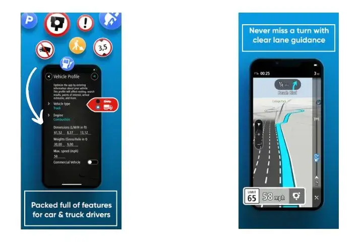
TomTom GO offers probably the most comprehensive Italian road coverage available, with detailed mapping that understands European driving conditions and traffic laws. As a paid service, it provides features that free apps often miss.
The offline capabilities are outstanding for Italian travel because maps are entirely downloaded to your device, eliminating concerns about cell coverage in mountainous areas or remote villages. The detail level includes small rural roads that other apps ignore.
Speed camera alerts and traffic enforcement warnings are incredibly accurate for Italian conditions. TomTom maintains updated databases of camera locations, ZTL zones, and traffic law changes that affect driving routes and costs.
Advanced lane guidance proves essential on complex Italian highway interchanges around major cities. Rome’s ring road, Milan’s tangenziali, and Naples’ highway approaches become manageable with clear visual guidance about lane positioning.
Garmin Drive specializes in comprehensive point-of-interest databases that enhance Italian road trips beyond basic navigation. Restaurant recommendations, fuel station locations, tourist attractions, and accommodation options integrate seamlessly with route planning.
The subscription costs for premium features vary but typically run €20-40 annually. Whether this provides value over free alternatives depends on your travel frequency and comfort level with technology troubleshooting.
Professional trucking and RV routes help larger vehicles navigate through Italian restrictions. Many historic centers prohibit large vehicles entirely, and mountain passes have weight and size limitations that specialized routing accounts for automatically.
- Consider paid apps for frequent European travel – features often justify costs
- Download complete maps before travel to ensure offline functionality
- Update regularly – Italian traffic laws and restrictions change frequently

Offline Navigation Solutions for Remote Italian Regions
Maps.me provides detailed offline navigation perfect for exploring remote Italian regions where cell coverage becomes unreliable or nonexistent. I use this app constantly for hiking, rural exploration, and discovering hidden villages.
The detailed mapping includes hiking trails, rural roads, and paths that major navigation apps ignore completely. For reaching secret beaches, mountain villages, or archaeological sites off tourist routes, Maps.me often provides the only reliable navigation option.
OsmAnd offers comprehensive OpenStreetMap data with incredible detail for Italian rural areas. The learning curve is steeper than in simpler apps, but the functionality rewards dedicated users who want maximum control over navigation options.
Here WeGo provides excellent offline capabilities combined with public transportation integration for Italian cities. When driving becomes impractical in historic centers, seamless transition to walking and transit directions proves invaluable.
CityMaps2Go focuses on tourist attractions and points of interest with offline functionality. For Italian cultural sites, restaurants, and accommodations, the curated information often surpasses general navigation apps.
Sygic GPS offers comprehensive offline European mapping with features specifically designed for road trip navigation. The interface balances functionality with ease of use better than some more technical alternatives.
Data usage minimization becomes crucial during extended Italian travel, especially with European roaming charges. Offline apps eliminate data costs while providing reliable navigation independent of cellular coverage quality.
- Download offline maps for entire regions before travel begins
- Test offline functionality at home to understand the interface and features
- Carry backup power – offline apps can drain batteries quickly
Italian-Specific Navigation Challenges and Solutions

ZTL (Zona Traffico Limitato) zones represent the biggest navigation challenge for Italian road trips because fines arrive weeks after your vacation ends. These restricted traffic areas exist in every historic city center and use cameras for automatic enforcement.
The ZTL detection varies dramatically between navigation apps. Some ignore restrictions entirely, others provide warnings, but not comprehensive coverage, and specialized Italian apps focus specifically on this challenge but may lack other features.
Historic center navigation requires understanding that many Italian cities weren’t designed for cars. Medieval streets are narrow, one-way systems change frequently, and parking options are extremely limited. Navigation apps help, but local knowledge remains essential.
Mountain pass seasonal closures affect route planning because many Alpine roads close from October through May due to snow conditions. Navigation apps don’t always reflect the current closure status, requiring manual verification through official sources.
Ferry connections for islands and some mainland routes need advance planning because schedules vary seasonally, and booking may be required. Navigation apps typically handle routing to ferry terminals but don’t integrate sailing schedules or reservation requirements.
Toll road calculation helps budget planning because Italian highway costs add up quickly during longer trips. Some apps estimate toll costs, while others ignore this significant expense entirely.
The location of emergency services becomes crucial in remote areas where cell coverage may be limited. Navigation apps with comprehensive emergency contact databases and multilingual support provide essential safety resources.
- Research ZTL zones independently before visiting Italian historic centers
- Check mountain pass conditions during winter and the shoulder seasons
- Verify ferry schedules manually – apps don’t always have current information
🧭 How to Avoid Navigation Mistakes in Italy
- Start with the complete Italy road trip planning guide → How to Plan a Perfect Italy Road Trip: Complete Guide
- Learn how ZTL zones affect navigation in cities → Italy ZTL Zones Driving Guide
- Follow popular scenic coastal drives without wrong turns → Italy Coastal Road Trip — Seaside Routes
Regional Navigation Considerations Across Italy
Northern Italy presents unique challenges with Alpine terrain, lake regions, and complex highway systems around major cities. Mountain roads close seasonally, lake routes involve narrow winding roads, and city navigation requires understanding local traffic patterns.
The Dolomites specifically challenge navigation apps because of rapid elevation changes, seasonal road closures, and limited cell coverage. Offline maps become essential, and weather conditions change rapidly enough to affect route safety.
Central Italy’s rural road networks through Tuscany and Umbria often involve narrow country roads that navigation apps sometimes mischaracterize. What appears as a main route might be a dirt track unsuitable for rental cars.
Southern Italy and Sicily present different challenges, with longer distances between services, more limited infrastructure in rural areas, and driving customs that differ from northern regions. Navigation apps may not account for these cultural differences.
Sardinia requires special consideration because it’s an island with unique geography and limited connectivity to mainland navigation databases. Ferry planning becomes essential, and rural road conditions may not reflect the current reality.
Coastal route planning involves understanding seasonal traffic patterns, especially during summer when beach access creates massive congestion. Navigation apps help, but local timing knowledge prevents hours of traffic.
Urban navigation in Rome, Milan, Florence, and Naples requires understanding that each city has unique traffic restrictions, limited parking, and public transportation alternatives that may be faster than driving.
- Adjust expectations by region – northern and southern Italy have different infrastructure
- Plan extra time for mountain and rural navigation challenges
- Research local traffic patterns for major tourist destinations

🌍 Coastal Roads, Mountains & City Centers
- Navigate tight cliffside roads safely along the Amalfi Coast → Amalfi Coast Road Trip — This Year’s Guide
- Use apps smarter in the mountains & lake regions → Northern Italy Road Trip — Lakes & Mountains
Navigation App Features Essential for Italian Road Trips
Real-time traffic updates prove essential for Italian highway travel because construction, accidents, and seasonal congestion create unpredictable delays. Apps that integrate live traffic data save hours during peak travel periods.
Points of interest databases enhance Italian road trips beyond basic navigation by suggesting restaurants, attractions, accommodations, and services along your route. Quality varies dramatically between apps, with local knowledge often superior to tourist-focused recommendations.
Voice guidance and hands-free operation ensure safe navigation and compliance with Italian traffic laws. Handling phones while driving results in substantial fines, making voice control essential for route adjustments and destination changes.
Route customization allows choosing between the fastest routes and scenic alternatives. Italian road trips often prioritize beautiful drives over efficiency, requiring apps that support multiple route preferences and easy switching between options.
Fuel station integration helps locate and compare prices, which is especially important in remote areas where stations may be sparse. Some apps include current pricing information, while others provide location-only data.
Weather integration becomes crucial for mountain navigation, where conditions change rapidly and affect route safety. Apps that adjust routing based on weather forecasts prevent dangerous situations and closed road encounters.
- Prioritize apps with comprehensive traffic integration for highway travel
- Test voice commands before travel to ensure reliable, hands-free operation
- Configure scenic route preferences for maximum Italian road trip enjoyment
Setup and Optimization Tips for Italian Navigation
Pre-trip configuration prevents navigation disasters during your Italian adventure. Download offline maps, configure preferences, and test functionality before depending on apps in unfamiliar territory.
Language settings affect both interface usability and voice guidance quality. Choose based on your comfort level with Italian pronunciation versus English interface familiarity. Mixed settings often provide optimal results.
Route preference customization should reflect Italian road trip priorities. The fastest routes work for highway travel, while avoiding highways reveals scenic countryside roads that create better experiences.
Battery optimization becomes crucial during long Italian driving days when navigation apps run continuously. Background app refresh, screen brightness, and location services dramatically affect battery life.
Backup navigation solutions provide essential redundancy when primary apps fail, lose signal, or provide incorrect information. Multiple apps with offline capabilities prevent navigation disasters in remote areas.
Integration with rental car systems varies by vehicle and app combination. Test connectivity, charging options, and display compatibility to ensure seamless operation during your trip.
Update scheduling ensures current information for Italian road conditions, traffic restrictions, and points of interest. Outdated navigation data causes problems that current information prevents.
- Test all features before travel to identify and resolve potential problems
- Configure multiple backup options – technology fails when you need it most
- Update everything immediately before departure for current information
🔧 Get Directions Right Every Time
Preview scenic + efficient routes with Italy’s classic 10-day itinerary → 10 Days Italy Road Trip Itinerary
Add authentic hidden gem detours with local map settings → Hidden Gems Italy Road Trip
Conclusion
Your navigation app choice for Italian road trips determines whether you’ll spend your vacation confidently exploring incredible destinations or frustratingly fighting with technology that doesn’t understand our unique driving challenges!
The right combination of apps, properly configured and understood, transforms navigation from a source of stress into a tool that enhances every aspect of your Italian adventure.
The secret to successful Italian navigation lies not in finding the perfect app but in understanding how different apps handle our specific challenges and using them strategically.
Remember that even the best navigation technology requires common sense, local awareness, and backup plans for when apps fail or provide questionable directions.
Some of Italy’s most incredible discoveries happen when you’re brave enough to ignore GPS suggestions and follow unmarked roads that lead to experiences no algorithm could predict.
Download offline maps, carry backup power, stay flexible when technology suggests impossible routes, and, most importantly, embrace the adventure spirit that makes road trips magical.
The perfect navigation setup serves your Italian dreams rather than limiting them. Navigate smart, drive safely, and prepare for discoveries that will exceed every digital prediction.
L’Italia ti aspetta con strade che cambieranno la tua vita! Italy awaits you with roads that will change your life! Andiamo!

Explore More
- Best Scenic Drives in Italy: Routes, Tips & Must-See Stops
- Winter Olympics Italy 2026 Travel Guide: Plan Your Trip by Car to Milan & Cortina
- How to Drive Italian Mountain Passes in Winter: Safety Tips, Gear & Scenic Routes
- The Best Agriturismo Stays in Tuscany for Your Italy Road Trip


Book Your Tour
Rent Car

💬 We’d love to hear from you!
Have questions, tips, or personal travel stories to share? Drop them in the comments below — your insights help fellow travelers plan their adventures too.